by Ken Bowker (NOSAS)
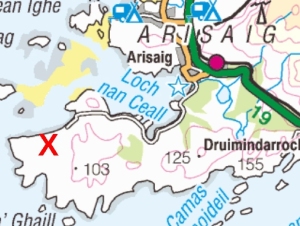
In the autumn of 2012, Jean and I were asked, because of our experience in survey and archaeology, to join Elizabeth and Allan MacDonald and half a dozen others from Arisaig, about twelve miles north of where we live, in order to do a walkover survey of the Rhu Peninsula, a virtually- deserted five by three miles stretch of very rough ground immediately south of Arisaig. Many people will know this area by the winding coastal road that runs along the north side of the peninsula and round the western tip to the old ferry pier at the end of the public road. Beyond this a track continues for a mile or more to the only two permanently-inhabited houses on Rhu. The ferry to the Small Isles berthed here in the days of sail because the way into Arisaig harbour was, and still is, very dangerous, with huge areas of drying reefs.
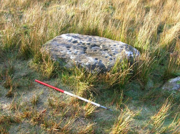
The current 1:25000 OS maps mark only a dozen or so features on Rhu Arisaig. In January 2014, as the survey restarted, we had over three hundred on the list, mostly townships, shielings, feannagan, cairns, enclosure walls and the like. But there is relatively little of real note on the peninsula, probably because until very recently it was too inaccessible even for the Antiquarians, with the one exception of the Reverend Jolly, who specialised in looking for cup-marked stones on his days off, and in 1885 very accurately recorded one of the very few west coast examples at Gaodeil, on the eastern border of our survey area.
Rhu is part of An Garbh Criochan, the Rough Bounds, an apt name; it is very volcanic, with massive basalt dyke swarms emanating 60 million years ago from Sligachan, on Skye, although the native rock is sandstone schist. Raised beaches occur all around the edge, with pebble beaches 100 feet above the sea. Having said that, there was enough cultivable land to support almost four hundred people prior to the 1850s, when there was the usual widespread emigration.
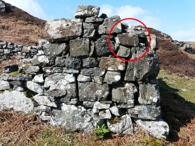
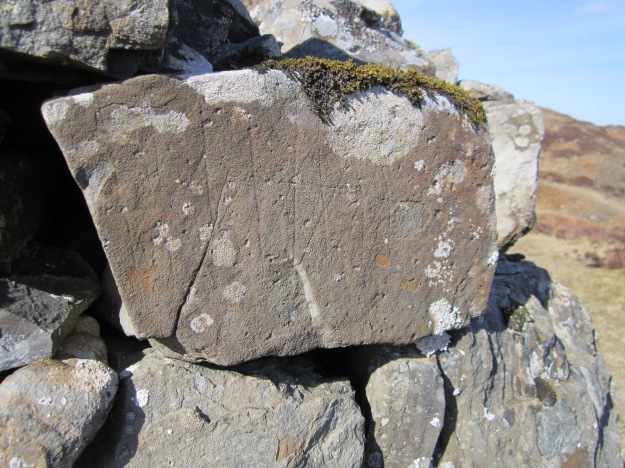
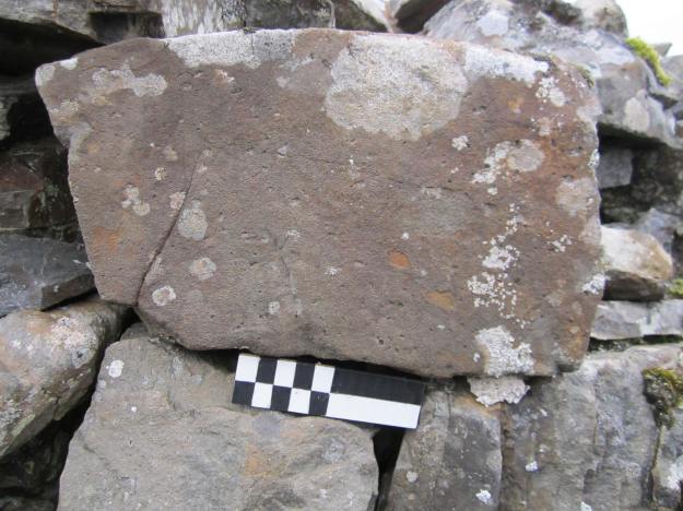
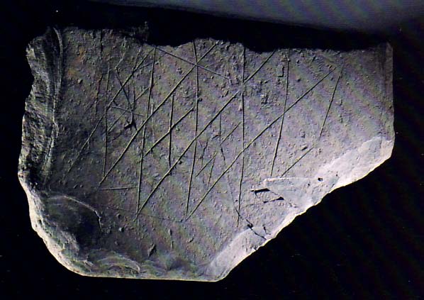
One sunny day in April 2013 the four of us were heading back at the end of the day’s walk, when Elizabeth MacDonald rounded the corner of a ruined house. She glanced towards the sunlight, which was slanting along the wall of the ruin, and she spotted distinct markings on a smooth basalt stone, just off the corner of the eastern wall; she looked closer, wondering aloud if they were Viking runes – but Jean and I were far more excited, because we had other suspicions.
I took photographs and started by sending them off to Jonie Guest for a NOSAS opinion. A couple of weeks later John Wombell arrived and confirmed what we suspected – the markings on the stone looked Neolithic. Subsequent exchanges with ten carved-stone specialists in Scotland and England confirmed this; one, Caroline Wickham-Jones, didn’t even bother to suggest what it was but merely asked “Where’s the Neolithic cairn?” We’d found an incised Neolithic stone.
Since flint does not occur naturally around here, the incisions, which are only 2mm or so deep, were probably made using quartzite; they are so shallow that Alison Sheridan of the National Museum of Scotland (NMS) later said it was a million- to-one that they were ever spotted. They can only be seen in good lighting conditions – on a grey day they are virtually-invisible, and a torch of some kind is invaluable in that situation.
The ruin is a rebuild of an earlier house and was lived in until 1900 by Duncan Moffat, a ditcher on the Arisaig Estate. The stone may have been chosen simply because it was the right shape – or it may be, as has been suggested by some, particularly Antonia Thomas of the UHI on Orkney, that it was apotropaic – set there to ward off evil – because it was perceived to have a magical history. Antonia sent me an image of an almost-identical stone found on Orkney in 2013 and has seen others in similar settings to that on Rhu.
John Wombell pointed out the potential for theft – the stone was easily-removed and only 50m from a driveable track; so we kept the find quiet, apart from consulting the specialists, until we had a professional come and look at it.
It wasn’t until October that John Borland of RCAHMS arrived to identify and record the stone, on a day so wild that three people had to hold the drafting paper steady while he drew it. Even after this, things moved slowly. I contacted the Trove specialists in the National Museum who said it was “a difficult one”. The stone was not in its original context, and, set in the wall, it was still part of a building with a known owner and therefore (probably, they thought) not Trove. If we moved it without permission from the owner, that would be theft – but if the landowner moved it, he could quite legally keep it on the mantelpiece. In the end it was agreed that if the landowner moved it to a place of safety, Trove would not apply.
The ruined building is owned, by good fortune, by an elderly local historian who said immediately that the stone should be on public view; even then, he went through the same hoops with Trove because, as he said he “wanted to do everything right”. The stone was finally moved just before Christmas and loaned permanently to the Land, Sea and Island Centre in Arisaig, where it will be on display as soon as suitable lighting is installed – as I said earlier, it is very difficult to see in normal light. If you’re in Arisaig, drop in and see it – it’s worth a visit.

Wow, what a find! Glad that it’s now been saved from obscurity! I shall be looking at all the stone walls from now on.
LikeLike
The diamond shaped petroglyphs can be found on many Viking stones and on Pillars at Gobekli Tepe in Turkey but have not worked out their significance.
LikeLike