Tag Archives: pictish symbol stone

The Kebbuck Stone, Ardersier: A Lost Pictish Symbol Stone?

by Fiona Campbell-Howes

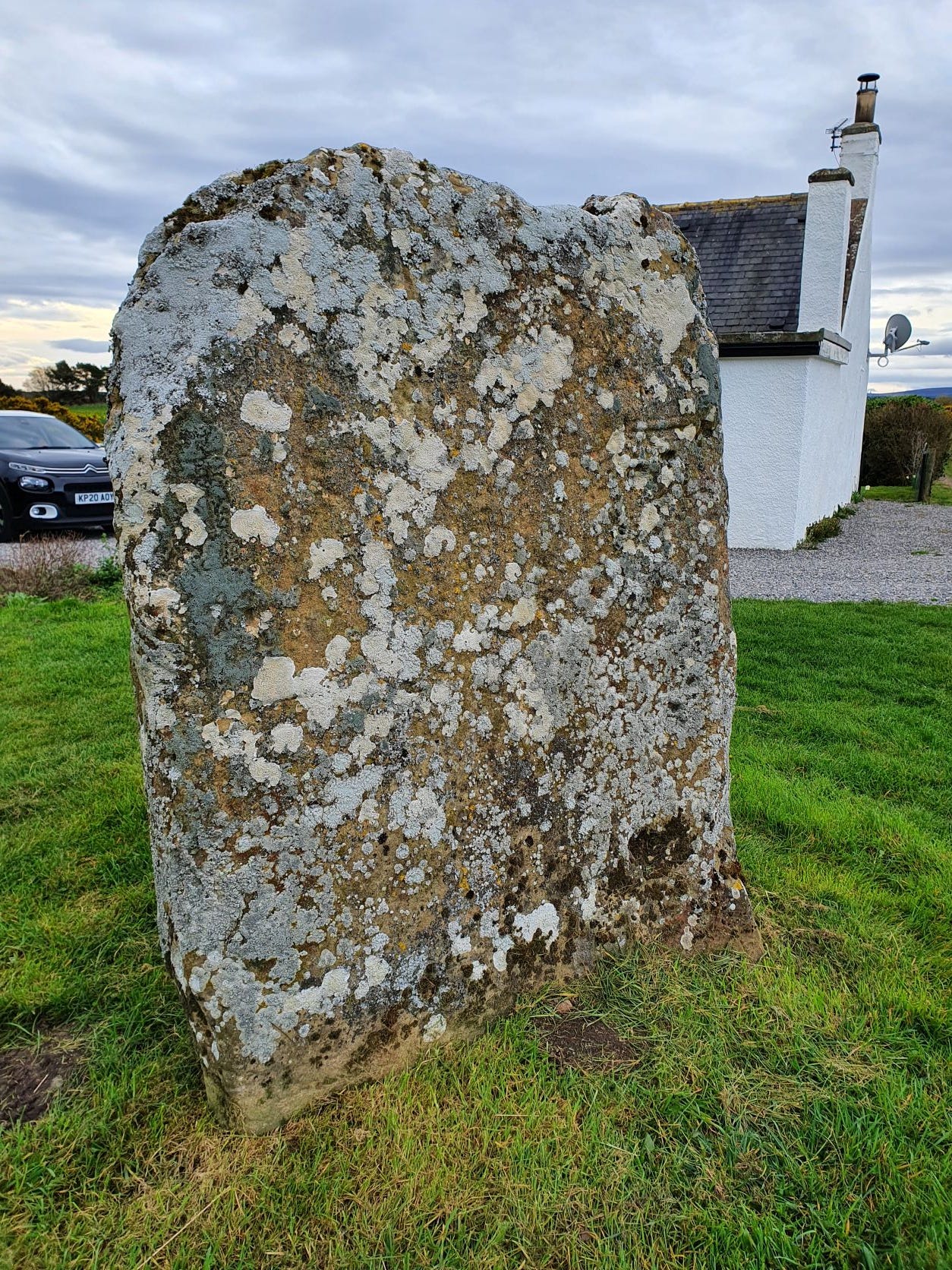
The cross-face of the Kebbuck Stone, eroded and overgrown with lichen

This is the Kebbuck Stone (see Canmore), a relief-carved cross slab dated to the 8th or 9th century, which today sits in the back garden of a cottage near Ardersier.

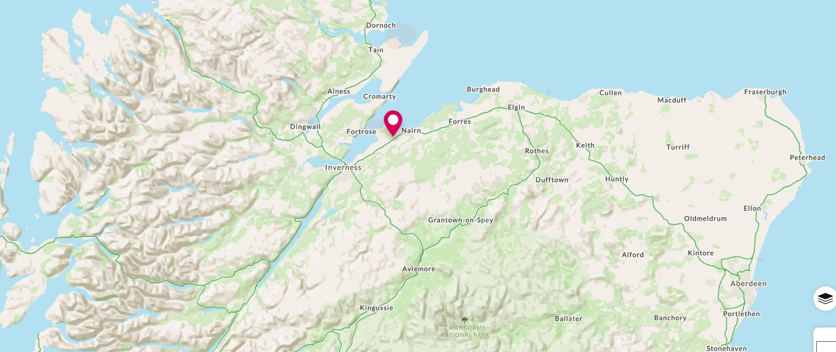
Map showing the location of the Kebbuck Stone in Nairnshire
Location of the Kebbuck Stone in Nairnshire


It’s usually overlooked in the corpus of early medieval (“Pictish”) stone sculpture because the carvings have almost completely worn away and the surface of the stone is overgrown with lichen.

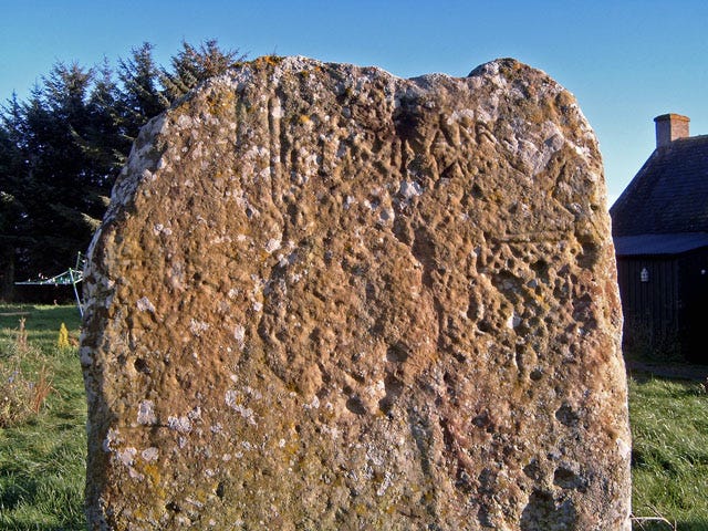
It was badly eroded even in 1893, when antiquarian George Bain wrote in his History of Nairnshire:

“The slab is very much wasted from the effects of weathering and ill-usage, but the faint outline of a Celtic cross can still be traced upon one side of it. It is a cross of the earliest form—incised and undecorated—and it would have made a most interesting memorial of early Christian times had it been better preserved.

Kebbuck Stone in evening sunlight, by Ian R. Maxwell (Geograph)
Continue reading

Pictish Eagles and the Strathpeffer Stone

by John Wombell (NOSAS)

There are 12 known Pictish Eagle carvings, all in the RCAHMS publication of 2008 ‘The Pictish Symbol Stones of Scotland’.  They vary considerably and by far the best known and the best preserved is on the Clach an Tiompain at Strathpeffer (HER MHG43542) meaning the ‘sounding stone’ but known more widely as the Eagle Stone.

There are many images of it in circulation but a week ago I took a new set of photos which Alan Thompson kindly processed for me using photogrammetry (see images above and below, as well as on Sketchfab).  The reason behind this was that I wanted to try to produce an engraving of it on wood and needed to see more detail that is not visible to eye or touch at the stone.

The Eagle Stone has had several lumps bashed off it in the past removing part of the horse shoe symbol and the eagle’s rear end.  Otherwise damage to the carving is minimal with only part of the eagle’s leading leg either fallen or bashed off.

My dilemma was whether to give the eagle a tail or not.  I feel sure that unlike most Pictish eagles this one was drawn from a live eagle depicted walking.  It is correct in a lot of detail even though the carving is full of symbolism.  I decided to give my version a short dipped tail represented as two feathers after one of the Orkney eagles. Continue reading

Rhynie Excavations Season 4 (2016)

By Cathy MacIver (on behalf of the REAP Project Team)

A fourth season of excavation took place at the Craw Stane, Rhynie over August – September 2016. The project was led by REAP Project Directors Dr Gordon Noble, University of Aberdeen and Dr Meggen Gondek, University of Chester.

Aerial photographs and geophysical surveys had identified curvilinear enclosures around the Craw Stane, one of the few symbol stones remaining in situ in Scotland (Plate 1).

image001

Plate 1: Craw Stane with Tap O ‘Noth hillfort (©Cathy MacIver)

Previous seasons of work at the Craw Stane (one of seven Class I Pictish symbol stones from the area) in 2011, 2012 and 2015 had demonstrated that these enclosures took the form of an inner and outer ditch and a later palisade structure with associated postholes.

Excavations in past seasons had revealed a number of high status objects including fragments of Late Roman Amphora, glass beads, metal pins, glass vessel fragments and evidence of metal working in the form of metal working tongs, slag (metal working waste) and clay moulds for metal objects. The features date the site to the early medieval period and radiocarbon dates from the ditches and other internal features confirmed a relatively short 5th-6th C construction, occupation and abandonment of the site.

image003

Plate 2: Rough draft of the excavations from 2011, 2012 and 2015. A work in progress!

The 2016 excavations aimed to investigate areas of the site that hadn’t been looked at before, continuing to use the successful strip and map approach employed in previous years. This involved 4 large areas or trenches (Plate 3) where the topsoil was removed by machine and watched by archaeologists. The areas were then cleaned by hand by a team of archaeologists, students and volunteers, using hoes, krafses and eventually trowels. This made archaeological features more visible and easier to record. Plans of the site were created using DGPS (accurate to the nearest cm) and aerial photography using a drone. Areas with more complexity were drawn by hand.

image005

Plate 3: Aerial view of the 2016 trenches

Continue reading

The Picts at Garbeg and Whitebridge

by James McComas (NOSAS)

The Pictish people of the mid to late first millenium AD once inhabited what is now northern and eastern Scotland. They left very little written record and the evidence of buildings so far identified are sparse. Perhaps their most obvious remains in the landscape are the enigmatic symbol stones and the imprints of their burial sites.

Although modern Angus and Perthshire have traditionally been seen as the Pictish heartland, in recent years new research is reveavaluating the importance of the northern picts, north of the Mounth. Two highland burial sites which feature impressive upstanding remains are to be found on opposite sides of Loch Ness; at Garbeg near Drumnadrochit, and at Whitebridge in Stratherrick. Pictish funerary practices appear to have been diverse (see our earlier blog post), however barrow* cemeteries have been identified as one recognisable form. Round and square type ditched barrows appear alongside each other at both Garbeg and Whitebridge – a feature thought to be unique to the Pictish cemetery.

Side by side comparison of a plan of part of the Garbeg cemetery and a quadcopter aerial photo by Alan Thompson. (The brown patches on the photo are the result of recent gorse clearance, and dark green areas are piles of cut vegetation.) The barrows excavated by Wedderburn and Grime on this plan are nos 1,2,3 and 8.

Side by side comparison of a plan of part of the Garbeg cemetery and a quadcopter aerial photo by Alan Thompson. (The brown patches on the photo are the result of recent gorse clearance, and dark green areas are piles of cut vegetation.) The barrows excavated by Wedderburn and Grime on this plan are nos 1,2,3 and 8.

Garbeg and Whitebridge were visited by NOSAS field trips in 2014/ 2015 and Garbeg has also been the subject of gorse clearance, quadcopter photography (blog post section 4) and QGIS survey by the group. Subsequently in 2015 many NOSAS members were involved with survey and excavation by the University of Aberdeen’s Northern Picts Project on possibly contemporaneous building remains at Garbeg.

The cemetery at Garbeg (Canmore ID 12281, HER MHG3361) consists of 23 square and round barrows with surrounding ditches. The barrows are thought to cover single long cist burials. They are situated on a natural plateau at an altitude of some 300m on open moorland used for rough grazing.  The immediately surrounding landscape is one rich in archaeological remains, including prehistoric field systems, groups of hut circles and a series of burnt mounds which are largely thought to predate the Pictish period.

Members of NOSAS at a field visit to Garbeg, November 2014

Members of NOSAS at a field visit to Garbeg, November 2014

Continue reading

A Cross Stone found in Rosemarkie

by Tim Blackie (NOSAS)

Rosemarkie Cross Stone (Tim Blackie)

Rosemarkie Cross Stone (Tim Blackie)

This intriguing carved, reworked and relatively portable piece of sandstone (0.32 x 0.38 x 0.15m) was originally located in a rockery in the garden of 1 High Street, Rosemarkie.

Neither the owners of the house nor the local community have any knowledge of its provenance. The find location at 1 High Street is at the south west top of the High Street close to Rosemarkie Church and ancient graveyard where many Pictish and medieval stones have been discovered. The owners were selling their house and offered it to me as I was intrigued with its most unusual design.

The front of the stone appears to bear the design of a cross carved in relief and the rear is flat. It may have originally been rectangular (possibly square or close to it) with a broad chamfered margin on at least three sides. The very prominent chamfer could be a feature of a cross slab associated with the early medieval Pictish centre at Rosemarkie but could equally point to being an architectural fragment with a later date. The fact that the chamfer has been partly removed and an arc cut out of the stone shows that the stone has been perhaps reworked and re-used for another purpose.

Continue reading

Excavations at Rhynie 2014

by Cathy MacIver (Rhynie Community Archaeologist, CMS Archaeology)

Earlier in September the Village Square in Rhynie, Aberdeenshire was a bustling hive of activity. Archaeologists, artists and locals got together for a week-long celebration of heritage and hospitality during the Art and Artefact Project (funded by HLF). This project was a collaboration between Dr Gordon Noble (University of Aberdeen) and Rhynie Woman, a local artists collective. The project capitalised on the research and fieldwork undertaken in and around Rhynie since 2005 by Gordon (Aberdeen) and Meggen (Chester) as part of the Rhynie Environs Archaeology Project (REAP). This work looked at the Craw Stane, the site of an in situ Pictish Symbol Stone and associated high status settlement as well as nearby square barrows with high status burials, including a female stone lined cist burial.

Following on from the success of the Pop-up Pictish café run by Daisy and Debbie during the 2013 season the Rhynie Woman collective applied for funding for a weeklong event in 2014. The project consisted of: a variety of art workshops; a Curiosity Café, displaying art created in and of the village; a programme of excavation to explore the Pictish past in Rhynie itself; an ever welcome stream of home baking and meals and hospitality for the archaeologists staying in Rhynie.

The archaeological side of the project consisted of a transect of 1 by 1m or 2 by 2m test pit excavations between the Village Square and the Surgery. This was to explore the find spots and concentrations of activity marked on the old OS map from 1866. This map marked the location of several symbol stones, human remains and an urn which had been discovered when the current main road was put through Rhynie. In addition to the Craw Stane, which is still in its original position to the south of the village, many other Pictish symbol stones have been found in and around Rhynie and are on display. We hoped to investigate the context for some of these stones in the area we were digging.

Craw Stone, Rhynie

Craw Stone, Rhynie

Our initial test pits in the Village Green and nearby gardens produced a lot of material from the 19th century (pottery, an old track, a couple of possible structures and a hard packed surface that was probably the original square surface). The depth of material covering these deposits suggests that the green has been used over a long period and several attempts to level the area have been made by the introduction and spreading of material.

The excitement started to build a couple of days into the project. By this time we had opened several test pits in gardens further to the south nearer the stone findspots. One test pit contained a large post or stone hole (possibly the socket for one of our stones??). This hole was surrounded by a low, rough cobbled structure foundation, possibly the base for a turf built wall. Another test pit in a neighbouring garden uncovered the remains of cairn material. This could be linked to the cairn reputed to have been at the site of one of the symbol stones. A quick glance over the wall showed a freshly harvested field and the rest of the low natural rise we were situated on, flat, open, inviting……

Continue reading