
by Roland Spencer-Jones (NOSAS)

In April 2015, NOSAS was approached by the development officer of Aigas Community Forest to see if we could undertake an survey of this newly acquired 285-hectare forest. The local community had completed the purchase of the forest from the Forestry Commission that month. Part of the sale conditions were that an archaeological survey would be required. After some discussion, mainly centred on the size of the task ahead, NOSAS said yes, and the two co-leaders of the survey – Roland Spencer-Jones (RSJ) and Anne Coombs (AC) – got into planning mode.
RSJ undertook a desk-based assessment of the history and known archaeology of the forest. This included searching the maps on the digital map resource of National Library of Scotland, the Canmore archive of Historic Environment Scotland, the local Highland Council’s Historic Environment Record and maps from the previous Lovat Estate archive. In addition he had conversations with local landowners and local community members who had either had personal experience of the forest and its history or had undertaken some research of their own. Two of these local landowners were able to provide old photographs that complemented the historical record.
This desk-based assessment concluded that:
- There was little forest cover in the area now covered by the forest in the mid-18th century when historical records first began. Much of land was covered in moor and moss, and was “good hill pasture” for grazing animals.
- Planting of the forest began in the mid-19th century at a time when part of the Aigas Estate was enclosed to both contain stock and to prevent grazing damage. This work was first developed by rich landowners from further south in the UK, as was happening with many other parts of Scotland at that time. A network of paths through the forest was started at this time.


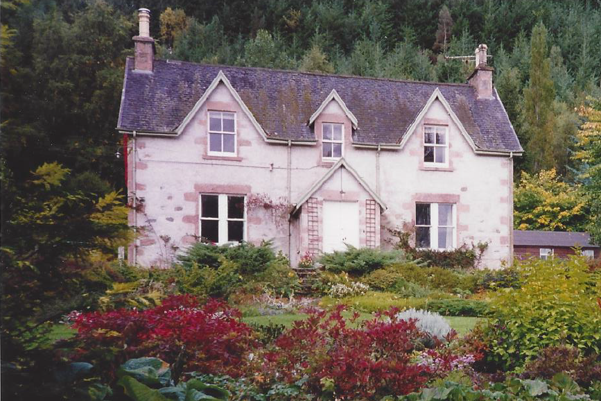
These three photographs demonstrate clearly the successive cropping of the Aigas Forest. The building is Aigas Mains farmhouse, on the southern border of the forest. The photographs are taken in 1933 (above left), 1960 (above right) and 1992 (right)
- From 1877 until the early 20th century the estate was further developed as a sporting estate, with further afforestation and further enclosure of the land. At this time many of the settlements bordering the forest were cleared, and consolidated in houses built in the Crask of Aigas village at the heart of the forest. The path network was expanded, and a road was constructed through the forest to reach the moor above it.
- The forest was progressively consolidated during the 20th century with successive cycles of planting and cropping. A significant harvest of the trees in the forest occurred in the early 1950’s, which means that it survived the felling that occurred in other Scottish forests during the two World Wars.
- The current forest cover represents a major planting of mixed conifer trees in the early 1960’s.
After an initial reconnaissance of the forest, and a preliminary walk through parts of the forest with the development officer and another forestry expert, RSJ & AC developed a survey plan that included the following components:
- To allocate a number of days over three months throughout the winter for the walkover survey
- To seek volunteer surveyors from both the NOSAS membership and the Aigas Forest membership
- To ensure that all surveyors used GPS gadgets to both track their waking route each day, and also to “waypoint” any artificial feature that they came across in their walking.
- To develop a rigorous health and safety plan that included the use of radio transmitters, walking in pairs or threes, and distribution of maps and compasses. The organisers wanted to ensure that nobody got lost whilst walking in the forest during what proved to be some challenging winter weather.
The GPS record of tracks on cumulative days of walking were plotted on QGIS software, which produced a fascinating survey record of spaghetti trails. See the maps below:

Day 1: 29.11.2015

Day 2: 13.12.15

Day 3: 04.01.16
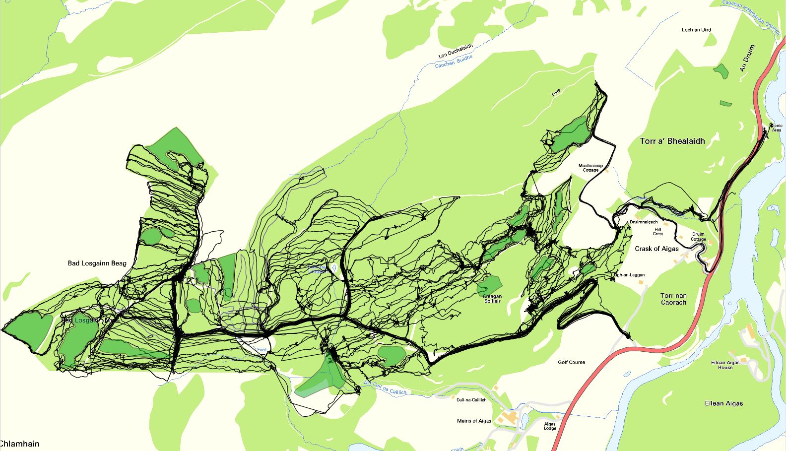
Day 4: 20.01.16

Day 5: 13.02.16

Day 6: 20.02.16
These six walking days were followed bya seventh day when the volunteers made dimensioned plans of some of the structures identified, and walked some of the linear features that had been identified – metal fences, dykes, tracks – in their entirety. So, the seven days of survey represented 77 person-days of walking, from a total of 27 survey volunteers (17 NOSAS, 10 Forest Community). Subsequent to these survey days, one of the organisers (RSJ) undertook several additional forays into the forest to clarify a few uncertainties and to make two more dimensioned plans of a stone bridge and a brick furnace.

So, what did we find? Even before the survey started it was clear that there was unlikely to be a lot of previously unknown archaeology in the forest. Settlements that were identified on the 1st edition Ordnance Survey map on the margins of the forest had been cleared by the turn of the 20th century. We did find, however, a previously unrecorded farm settlement in the higher part of the forest, some 19th century probable shooting butts, the remains of one of those cleared marginal settlement and evidence of previous peat cutting.
What became increasingly interesting during the survey, however, was to correlate the known historical development of the forest, from mid-18th century until the major 1960’s planting, with what we identified on the ground. We came across old forest banks, a magnificent line of iron fencing and gateways, and a network of paths radiating out from Aigas Mains farm into the forest towards the higher marginal settlements and the moor above the forest. The site of an old summer house in the middle of the forest still provided magnificent views over the gorge of the Beauly river.

1st edition (1872) map of Aigas Forest area, showing paths in blue, and fences in orange
The network of paths on the 1872 OS map, most of which are still present on the ground, is shown above.
The full report of the survey can be found here. A few photos of interesting finds follow.

A double-skinned brick building associated with a mid-20th century sawmill. Possibly a furnace, or a wood-drying kiln.

Above and below: Two bridges and three, very different, water tanks.


The results of the survey fed directly into the Community Forest’s long-term forest plan, identifying:
- a range of structures that would need to be protected during any subsequent forestry operations
- a network of paths that will form the basis of an amenity path network for walkers and cyclists
- the archaeological evidence for the historical development of the forest.
