Monthly Archives: December 2016

A Walkover Survey of Aigas Community Forest

by Roland Spencer-Jones (NOSAS)

20160919_093451-sm

In April 2015, NOSAS was approached by the development officer of Aigas Community Forest to see if we could undertake an survey of this newly acquired 285-hectare forest. The local community had completed the purchase of the forest from the Forestry Commission that month. Part of the sale conditions were that an archaeological survey would be required. After some discussion, mainly centred on the size of the task ahead, NOSAS said yes, and the two co-leaders of the survey – Roland Spencer-Jones (RSJ) and Anne Coombs (AC) – got into planning mode.

RSJ undertook a desk-based assessment of the history and known archaeology of the forest. This included searching the maps on the digital map resource of National Library of Scotland, the Canmore archive of Historic Environment Scotland, the local Highland Council’s Historic Environment Record and maps from the previous Lovat Estate archive. In addition he had conversations with local landowners and local community members who had either had personal experience of the forest and its history or had undertaken some research of their own. Two of these local landowners were able to provide old photographs that complemented the historical record.

This desk-based assessment concluded that:

  • There was little forest cover in the area now covered by the forest in the mid-18th century when historical records first began. Much of land was covered in moor and moss, and was “good hill pasture” for grazing animals.
  • Planting of the forest began in the mid-19th century at a time when part of the Aigas Estate was enclosed to both contain stock and to prevent grazing damage. This work was first developed by rich landowners from further south in the UK, as was happening with many other parts of Scotland at that time. A network of paths through the forest was started at this time.

19331960-31992-cropped

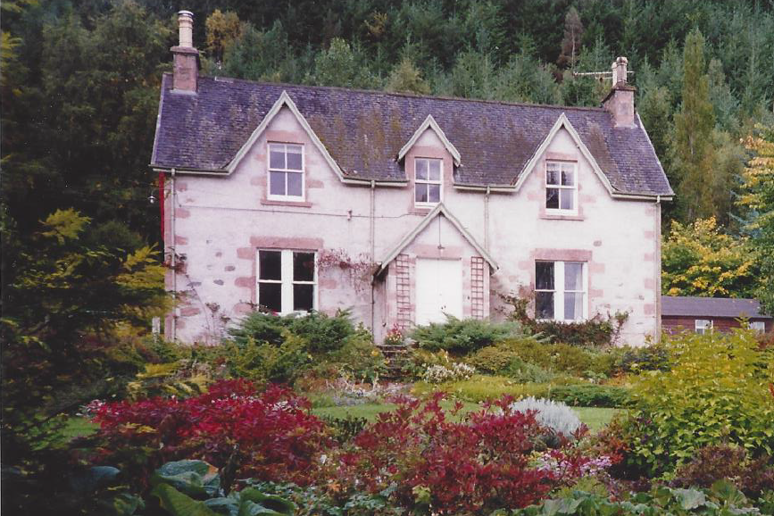
These three photographs demonstrate clearly the successive cropping of the Aigas Forest. The building is Aigas Mains farmhouse, on the southern border of the forest. The photographs are taken in 1933 (above left), 1960 (above right) and 1992 (right)


  • From 1877 until the early 20th century the estate was further developed as a sporting estate, with further afforestation and further enclosure of the land. At this time many of the settlements bordering the forest were cleared, and consolidated in houses built in the Crask of Aigas village at the heart of the forest. The path network was expanded, and a road was constructed through the forest to reach the moor above it.
  • The forest was progressively consolidated during the 20th century with successive cycles of planting and cropping. A significant harvest of the trees in the forest occurred in the early 1950’s, which means that it survived the felling that occurred in other Scottish forests during the two World Wars.
  • The current forest cover represents a major planting of mixed conifer trees in the early 1960’s.

Continue reading

Rhynie Excavations Season 4 (2016)

By Cathy MacIver (on behalf of the REAP Project Team)

A fourth season of excavation took place at the Craw Stane, Rhynie over August – September 2016. The project was led by REAP Project Directors Dr Gordon Noble, University of Aberdeen and Dr Meggen Gondek, University of Chester.

Aerial photographs and geophysical surveys had identified curvilinear enclosures around the Craw Stane, one of the few symbol stones remaining in situ in Scotland (Plate 1).

image001

Plate 1: Craw Stane with Tap O ‘Noth hillfort (©Cathy MacIver)

Previous seasons of work at the Craw Stane (one of seven Class I Pictish symbol stones from the area) in 2011, 2012 and 2015 had demonstrated that these enclosures took the form of an inner and outer ditch and a later palisade structure with associated postholes.

Excavations in past seasons had revealed a number of high status objects including fragments of Late Roman Amphora, glass beads, metal pins, glass vessel fragments and evidence of metal working in the form of metal working tongs, slag (metal working waste) and clay moulds for metal objects. The features date the site to the early medieval period and radiocarbon dates from the ditches and other internal features confirmed a relatively short 5th-6th C construction, occupation and abandonment of the site.

image003

Plate 2: Rough draft of the excavations from 2011, 2012 and 2015. A work in progress!

The 2016 excavations aimed to investigate areas of the site that hadn’t been looked at before, continuing to use the successful strip and map approach employed in previous years. This involved 4 large areas or trenches (Plate 3) where the topsoil was removed by machine and watched by archaeologists. The areas were then cleaned by hand by a team of archaeologists, students and volunteers, using hoes, krafses and eventually trowels. This made archaeological features more visible and easier to record. Plans of the site were created using DGPS (accurate to the nearest cm) and aerial photography using a drone. Areas with more complexity were drawn by hand.

image005

Plate 3: Aerial view of the 2016 trenches

Continue reading

The Discovery and Recording of a Victorian Hydro scheme at Orrin Falls, Ross-shire

by Meryl Marshall (NOSAS)

Aultgowrie, west of Muir of Ord, is a favourite area for short walks and I have been aware of a hydro scheme at Orrin Falls for many years but never given it much thought. However when I was browsing the Fairburn Estate website looking for something else I came across a photograph c1900 (below) and the following comment:

John Stirling used estate workmen to build a turbine house at the Orrin Falls and one further up river under the supervision of Mr Bagot from Glasgow and electric light was installed (in Fairburn House) in 1898.

The hydro-scheme was much older than I had thought and was worthy of more attention! For many years it had been overgrown with rhododendrons and overhung with trees however a few years ago the estate had carried out a programme of clearing these and it was more accessible. The site is marked on the current OS map as “weir” but there was obviously much more to it than that. It was unrecorded on the Local database http://her.highland.gov.uk/ and on the National database https://canmore.org.uk/.  So 18 months ago I set about gathering more information.

falls-of-orrin-1883

The Orrin Falls, GR NH 469517, are (or were) a series of attractive waterfalls (see painting above) within a gorge of the River Orrin. The natural rock is conglomerate and the total height drop from top to bottom of the gorge is roughly 15m. The hydro scheme is on the south bank of the gorge and comprises

  1. A dam
  2. The remains of an earlier dam
  3. A lade or channel
  4. A generator house.

And several other features;

  1. A rock-cut channel (on the north bank) probably intended as a salmon ladder
  2. The abutments of a footbridge
orrin-falls-hydro-c1900

The early photograph of the dam circa 1900 – reproduced with the permission of Fairburn Estate

Continue reading