Tag Archives: radiocarbon dates

The NOSAS Crannogs Project

by Richard Guest

I have long been fascinated by crannogs. These are articial island dwellings such as the one in Loch Achilty, pictured above (see Canmore).  I remember back in the 80’s tiptoeing across a partly submerged causeway to visit one in a Shetland lochan.  Then, later, visiting the reconstruction in Loch Tay and seeing a TV programme about it.  Later still, whilst on a Nautical Archaeology Society training course I met one of the divers who had been on the Loch Tay project and heard first hand what it was like to make such amazing discoveries.

About 10 years ago, my late wife Jonie and I decided to try and walk out to the Redcastle crannog in the Beauly Firth (see Canmore).  About twenty squelchy steps was enough to convince us that this was a BAD IDEA and we retreated to solid land.  And oh! The smell!  So the next expedition was by boat at high tide and we passed over Phopachy crannog (see Canmore), which we could see on the sounder but could make nothing out through the water.  Another trip at a lower state of tide, we could see the crannog but the water around it was too shallow to approach in the boat.  We didn’t try again.

What we did do was to dive around another crannog, the one in Loch Brora (see Canmore).  The water was so peaty we saw literally nothing.  We knew we had reached the bottom when we felt it beneath us.  I put my hand in front of my mask but couldn’t see it, even with a powerful torch.  I think I could feel some square timber but it might have been a modern fence post caught in weed.

More recently I became aware, through both diving and archaeology sources, of discoveries of Neolithic pottery found underwater around crannogs in the western isles (see Current Archaeology article).  This exploded the received wisdom that crannogs were of iron age to post medieval date.  Then in 2021 NOSAS were lucky enough to have a “Zoom” lecture about crannogs, by Michael Stratigos from the University of York, which is available on You Tube (below). This is when the idea for a NOSAS crannogs project was born.

Continue reading

TARRADALE THROUGH TIME: community engagement with archaeology in the Highlands

by Dr Eric Grant (NOSAS)

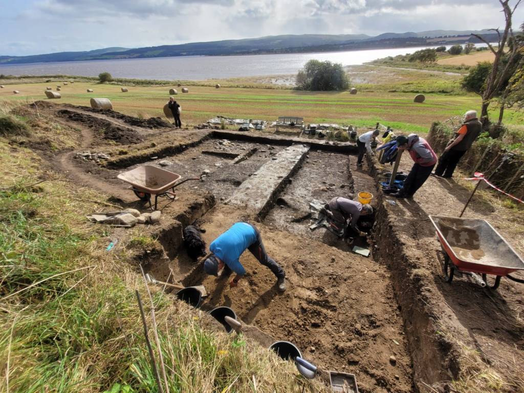
Trench 2B at Tarradale during excavations in October 2017.

Background to Tarradale through time

This blog sets out some of the recent developments in the TARRADALE THROUGH TIME project (see website), a NOSAS led project that commenced in 2017 and is supported by the Heritage Lottery Fund and Historic Environment Scotland and private donors. TARRADALE THROUGH TIME grew out of the earlier Tarradale Archaeological Project which is still ongoing as a mainly field walking and data gathering exercise – see Tarradale Archaeological Project blog . Field walking over the last few years has produced a great deal of data which has been recorded and mapped and the patterns emerging from mapping and analysis suggest that there were several important archaeological sites within the Tarradale study area that merited further investigation. A detailed research project was drawn up as a multiperiod investigation and given the name of TARRADALE THROUGH TIME. The sub title of the project is community engagement with archaeology in the Highlands, as one of the aims of TARRADALE THROUGH TIME is to engage with the local community in order to widen access to heritage through research and understanding and to underline the premise that archaeology belongs to the community and not just to the archaeologists who explore it. The Tarradale Through Time website can be found at www.tarradalethroughtime.co.uk.

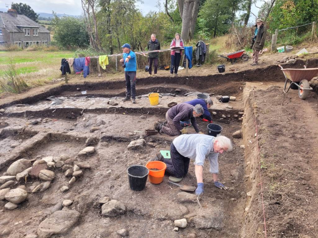
Community volunteers at the Tarradale castle site excavations, September 2017.

The Heritage Lottery Fund awarded the project a grant in 2017 and additional funding for specific aspects of the project was sought from Historic Environment Scotland. TARRADALE THROUGH TIME is focusing on five specific subproject areas for excavation and one subproject for detailed surface survey. These were chosen to give as wide a chronological range as possible in order to investigate the relationship between the inhabitants of the Tarradale area with their environment and landscape through time. The currently formulated subprojects are

  • investigating through test pitting and larger scale excavation Mesolithic (and potentially later) shell middens
  • a large barrow cemetery potentially dating from Bronze Age to Pictish
  • a large ditched enclosure with internal structures also likely to date from Bronze Age to Pictish
  • a small Inland promontory fort of unknown age
  • a ditch defended enclosed settlement of possible medieval date
  • the site of the historically recorded Tarradale Castle but whose exact location is unknown
  • surface survey and investigation of deserted postmediaeval agricultural townships or settlement clusters.

Continue reading

Clachtoll Broch Excavations 2017: Part Two

by Dave McBain (Historic Assynt)

Image: AOC Archaeology.

Three months ago, I was asked to write a piece on the Clachtoll excavation (see the post here), and when I was asked to do a follow up, I thought it would be best to have a look back and see where to start from. That was a revelation. When I penned the last piece,  we were a month in, enjoying every minute and let’s be brutally honest – not finding too many artefacts.

As time went on, we dug deeper, the finds became more frequent – much more frequent and in amongst it all, a mini dig on top of the Split Rock and the creation of a corbelled cell (soon, we hope,  to be otter holt) made for a fantastic summer.

So much to share, so few words – so let’s not waste any more.

View of 3d model of the broch towards the end of excavation, Sep 2017.

I suggested that the occupants may have had sheep or goats in my last blog report – we can confirm those sheep, from some of the bones found. Curiously, if a good few years later, Ptolemy’s map of Scotland listed the people of the North West as Caereni – or “sheep people”. I can only wonder if it was those same Caereni who built the Broch?

There were also cattle, pig, deer, whale, seal and possibly boar bones recovered on the site. I am pleased however, to report that to the best of my knowledge, no human bones came from the site, so we can hope our Caereni survived the collapse.

Clachtoll has turned out to be something amazing. Although several hundred brochs were built around Scotland, most it seems, fell gradually out of use before being abandoned. Finding another that collapsed dramatically in the iron age is a bit like searching for hens’ teeth. What we uncovered this summer was a two thousand year old time capsule. One has to wonder if one of the thousand plus visitors to the site was H.G. Wells time traveller looking for an update?

Continue reading

Clachtoll Broch Excavations 2017: The First Month

by Dave McBain (Historic Assynt)

Exterior view of the broch

The excavation at Clachtoll broch has been running for just over a month and with each passing day, the excitement seems to be growing. Clachtoll ticks so many boxes in this aging student’s checklist, it’s hard not to ramble on about it.

Carbon dating tells us that two thousand years ago, someone piled stones forty odd foot high – current estimates from the amount of rubble put the broch at 12-14 metres.  I’m far from a pro and not a great judge of distance, so like to describe that as a little higher than a three-storey house. What were they thinking? Was Clachtoll a key location on the West coast in the iron age? Why put what is surely the largest broch on the West coast there?

Image of 3D Model, created from photos taken 29th July (James McComas). Full model at the foot of the post.

The excavation is a community run project. After some frankly amazing fundraising, Historic Assynt have raised enough to get in a team of professionals for not just the dig, but a series of workshops, site tours, a little bit of experimental archaeology – next week, a corbelled cell will be built and potentially some local otters may get a new home as an outcome and most importantly it will result in a legacy attraction (complete with new path created from the spoil heap) for future visitors.

Then there’s the manner of the collapse. Most broch’s fell out of use gradually. For one reason or another, their occupants abandoned them, died out or may even have been removed. Many have suffered a gradual collapse over the years – in some cases tens of centuries after their initial construction.

The belief is, that Clachtoll is different. Like many others it collapsed, but in Clachtoll it might have been catastrophic, contemporary, and conclusive enough to prevent re-entry or re-use. Continue reading

Introducing Rosemarkie Man: A Pictish Period Cave Burial on the Black Isle

by James McComas (NOSAS & RCP)

The Pictish period skeletal remains, c . 430 – 630 AD, of a robust young man with severe cranial and facial injuries was found by archaeologists in a cave on the Black Isle in 2016. As has been widely reported, a facial reconstruction of the man was later produced by Dame Sue Black and her team at the University of Dundee. This is an account of the story from a digger’s perspective.

The Rosemarkie Caves Project (RCP), founded and led by Simon Gunn as a part of NOSAS, has since 2006 investigated the archaeological potential of a range of 19 caves on a 2.5 mile stretch of coast north of Rosemarkie. Activities have included comprehensive surveys, test pitting and fuller excavations (see our earlier blog post for an introduction).

In September 2016 it was decided that a full two week excavation would be carried out at “Cave 2B” where previous test pitting results had been revealing some interesting results. Here animal bone and charcoal excavated from depth of over one metre had yielded calibrated radio carbon dates of 600 – 770 AD, which is generally regarded as the Pictish period in Scotland. In addition this particular cave also had an unusual built wall structure spanning its entrance. It was felt by the RCP Committee that these factors made it a prime site for more detailed excavation.

Cavefull (JMcComas)

View of the cave towards of end of the 2016 excavation. The excavation area had now been divided into quadrants. Note the substantial wall in the entrance.

The Rosemarkie Caves Project was extremely fortunate to have experienced professional archaeologist Steve Birch volunteer to direct the excavation full time. In addition Mary Peteranna was also in attendance on a number of days when her duties as Operations Manager at AOC Archaeology would allow. I had signed up as a volunteer for almost the full term along with the rest of a small but enthusiastic team.

What was meant to be the final day of the dig started like any other. We had already had a successful two weeks, having identified a potentially important iron working site. That morning I was hoping to be able take out a section in the wall entrance in pursuit of a possible slot feature there. However I was somewhat disappointed to be deployed in the NW quadrant at the back of the cave, where a cobbled surface had previously been removed and a depth of midden material still remained to be worked back. Continue reading

Rhynie Excavations Season 4 (2016)

By Cathy MacIver (on behalf of the REAP Project Team)

A fourth season of excavation took place at the Craw Stane, Rhynie over August – September 2016. The project was led by REAP Project Directors Dr Gordon Noble, University of Aberdeen and Dr Meggen Gondek, University of Chester.

Aerial photographs and geophysical surveys had identified curvilinear enclosures around the Craw Stane, one of the few symbol stones remaining in situ in Scotland (Plate 1).

image001

Plate 1: Craw Stane with Tap O ‘Noth hillfort (©Cathy MacIver)

Previous seasons of work at the Craw Stane (one of seven Class I Pictish symbol stones from the area) in 2011, 2012 and 2015 had demonstrated that these enclosures took the form of an inner and outer ditch and a later palisade structure with associated postholes.

Excavations in past seasons had revealed a number of high status objects including fragments of Late Roman Amphora, glass beads, metal pins, glass vessel fragments and evidence of metal working in the form of metal working tongs, slag (metal working waste) and clay moulds for metal objects. The features date the site to the early medieval period and radiocarbon dates from the ditches and other internal features confirmed a relatively short 5th-6th C construction, occupation and abandonment of the site.

image003

Plate 2: Rough draft of the excavations from 2011, 2012 and 2015. A work in progress!

The 2016 excavations aimed to investigate areas of the site that hadn’t been looked at before, continuing to use the successful strip and map approach employed in previous years. This involved 4 large areas or trenches (Plate 3) where the topsoil was removed by machine and watched by archaeologists. The areas were then cleaned by hand by a team of archaeologists, students and volunteers, using hoes, krafses and eventually trowels. This made archaeological features more visible and easier to record. Plans of the site were created using DGPS (accurate to the nearest cm) and aerial photography using a drone. Areas with more complexity were drawn by hand.

image005

Plate 3: Aerial view of the 2016 trenches

Continue reading

Craig Phadrig Vitrified Hillfort, Inverness

The following is based on a transcript of notes by Mary Peteranna (AOC) for her presentation at the Highland Archaeology Festival Conference 2015. It describes fieldwork at Craig Phadrig hillfort carried out by AOC Archaeology in early 2015 on behalf of Forestry Commission Scotland, see Data Structure Report.

Craig Phadrig (Canmore ID 13486, HER MHG 3809) is located on the west side of lnverness, a prominent position overlooking River Ness and entrance to the Beauly/Moray Firth. The Beauly Firth marked a southern boundary of an area defined in the north by the Dornoch Firth landscape, supposedly held by the Decantae tribe in the lron Age as shown in Ptolemy’s map. Knock Farrell and Ord Hill hillforts are in line of sight, and a third possible fort is at Torvean In Inverness (Canmore ID 13549, HER MHG 3749).

2892 Craig Phadrig AP 3 (low res)

Aerial view of Craig Phadrig, Inverness, the Kessock Bridge and Ord Hill (Forestry Commission Scotland).

Craig Phadrig LANDSCAPE (low res)

A visualisation of the same scene as it might have appeared in prehistory (Forestry Commission Scotland).

Craig Phadrig is a prominent landscape feature, referred to at the time of James Vl in 1592. It is an oblong fort, a type which clusters around the Moray Firth region. Similar forts in East Scotland such as Finavon, Dunnideer and Tap o’ Noth also feature lack of entrance and massive walls suggesting an exclusive use. Many show evidence for lron Age construction, abandonment and secondary re-use.

Previous survey and excavation. Numerous previous surveys have been conducted on Craig Phadrig, probably sparked by Penant’s 1769 Tour of Scotland where he mentions vitrified stone. Plan shows the 2013 RCAHMS survey with the estimated area of these excavations.

canmore_image_SC01386712

Craig Phadrig. Plan of fort incorporating results of RCAHMS survey (Sept 2013) and earlier surveys (Canmore).

Finally, in 1971/72 Alan Small and Barry Cottam dug for two seasons, from which only an interim report after the first season was produced. lmage of the inner rampart from 1971; Small found that the inner rampart had been built sometime in the 4th Century BC and that the wall core was significantly vitrified. He also noted significant disturbance by other earlier excavations.

Continue reading

The Achavanich Beaker Burial Project: New Research on the Bronze Age of Northern Scotland

by Maya Hoole

In 2014, whilst working with the Highland Council Historic Environment Team, I came across the record of a Bronze Age beaker burial from Caithness in the Highland HER records (MHG13613). Although the site was discovered and subject to a rescue excavation in 1987, and some preliminary post-excavation had been undertaken, it had never been fully researched or published. The burial was positioned in a rare rock-cut pit with a stone lined cist, complete with cap stone. Inside were the remains of a young female (fondly known as Ava, her name an abbreviation of the place of discovery), aged 18-22 years old, accompanied by: a highly decorated beaker, three pieces of flint and the scapula of an ox or cow. Within seconds of opening the file and starting to read I was completely captivated. At that moment, I had no idea of the impact of my curiosity. I was totally clueless as to what was in store and completely oblivious to the fact that two years down the line my passion for the site would not only have increased but it would have extended far beyond myself.

The Beaker from the Achavanich cist burial (Maya Hoole©)

The Beaker from the Achavanich cist burial (Maya Hoole©)

The project began with my own research: I sorted the paper archives, located the artefacts at the Caithness Horizons museum, and subsequently photographed, measured, recorded and illustrated them. I went on to: re-discover the exact location of the site, re-create site plans, analyse the decoration on the beaker, make comparisons on a national scale and build a database and complete record of the artefacts. I bashfully presented my findings at a couple of conferences and… then things started to get interesting. At the very heart of the project was research. The initial goal was always to find out more about the individual buried at this site and to increase our knowledge of Bronze Age society in Northern Scotland. With the help of many different organisations and individuals, I applied for funding and soon found myself talking to experts (and to BBC news reporters, twice!) who were interested in developing our understanding of the site.

Dr Tom Booth of Natural History Museum examining the cranium from the Achavanich cist burial (Maya Hoole©)

Dr Tom Booth of Natural History Museum examining the cranium from the Achavanich cist burial (Maya Hoole©)

Continue reading

The Picts at Garbeg and Whitebridge

by James McComas (NOSAS)

The Pictish people of the mid to late first millenium AD once inhabited what is now northern and eastern Scotland. They left very little written record and the evidence of buildings so far identified are sparse. Perhaps their most obvious remains in the landscape are the enigmatic symbol stones and the imprints of their burial sites.

Although modern Angus and Perthshire have traditionally been seen as the Pictish heartland, in recent years new research is reveavaluating the importance of the northern picts, north of the Mounth. Two highland burial sites which feature impressive upstanding remains are to be found on opposite sides of Loch Ness; at Garbeg near Drumnadrochit, and at Whitebridge in Stratherrick. Pictish funerary practices appear to have been diverse (see our earlier blog post), however barrow* cemeteries have been identified as one recognisable form. Round and square type ditched barrows appear alongside each other at both Garbeg and Whitebridge – a feature thought to be unique to the Pictish cemetery.

Side by side comparison of a plan of part of the Garbeg cemetery and a quadcopter aerial photo by Alan Thompson. (The brown patches on the photo are the result of recent gorse clearance, and dark green areas are piles of cut vegetation.) The barrows excavated by Wedderburn and Grime on this plan are nos 1,2,3 and 8.

Side by side comparison of a plan of part of the Garbeg cemetery and a quadcopter aerial photo by Alan Thompson. (The brown patches on the photo are the result of recent gorse clearance, and dark green areas are piles of cut vegetation.) The barrows excavated by Wedderburn and Grime on this plan are nos 1,2,3 and 8.

Garbeg and Whitebridge were visited by NOSAS field trips in 2014/ 2015 and Garbeg has also been the subject of gorse clearance, quadcopter photography (blog post section 4) and QGIS survey by the group. Subsequently in 2015 many NOSAS members were involved with survey and excavation by the University of Aberdeen’s Northern Picts Project on possibly contemporaneous building remains at Garbeg.

The cemetery at Garbeg (Canmore ID 12281, HER MHG3361) consists of 23 square and round barrows with surrounding ditches. The barrows are thought to cover single long cist burials. They are situated on a natural plateau at an altitude of some 300m on open moorland used for rough grazing.  The immediately surrounding landscape is one rich in archaeological remains, including prehistoric field systems, groups of hut circles and a series of burnt mounds which are largely thought to predate the Pictish period.

Members of NOSAS at a field visit to Garbeg, November 2014

Members of NOSAS at a field visit to Garbeg, November 2014

Continue reading

Tarradale Archaeological Project – Findings to Date

by Dr. Eric Grant (NOSAS)

Background to the project. The Tarradale Archaeological Project started as a private initiative around 2008 and was incorporated as an approved NOSAS research project in 2011. The Tarradale archaeological project aims to investigate and record the surviving archaeological evidence of the multi-period archaeological landscape of the Tarradale area and to interpret the chronological development of settlement and resource utilisation in the study area. The main activity of the project so far has been field walking which has been very successful and as data has been collected and analysed the parameters of the project have moved and the aims extended.

Aerial photo of Tarradale area with Tarradale house in the foreground. Tarradale Castle (destroyed 1308) was probably located above and below the steep bank in the field immediately below Tarradale House. ). (Picture by courtesy of Jim bone).

Aerial photo of Tarradale area with Tarradale house in the foreground. Tarradale Castle (destroyed 1308) was probably located above and below the steep bank in the field immediately below Tarradale House. (Picture by courtesy of Jim Bone).

1. Location and extent of the Tarradale study area. The study area comprises about 750 hectares of mainly agricultural land at the eastern end of the parish of Urray on the northern side of the inner Beauly Firth in Ross-shire. Historically the area was co-terminous with the old landholding unit of Tarradale  estate and the ecclesiastical parish of Gilchrist or Tarradale, which was a separate parish until becoming amalgamated with the parish of Urray in the late 16th The historical centre of Tarradale was the old parish church, now surviving only as a mausoleum at Gilchrist. Following the building (or rebuilding) of Tarradale House in the 17th century, Tarradale House became the administrative centre (caput) of the estate.

A large part of the area is raised estuarine beaches and that area today is flat or gently undulating high-quality agricultural land that is regularly ploughed. To the north of the former raised beaches the land rises towards the Mulbuie Ridge as undulating hillside mainly covered with boulder clay. Apart from Gilchrist Chapel and some standing stones probably erected in the Bronze Age, there are few visible archaeological monuments in the area that is intensively ploughed, although aerial photographs show cropmarks that can be interpreted as ring ditches, pits and enclosures. This contrasts with the more upland and less intensively cultivated area where there are standing monuments including Tarradale chambered cairn and an indeterminate feature which has been called a henge but is better referred to with the more general term of earthwork.

Tarradale chambered cairn

Tarradale chambered cairn

Continue reading