by Marion Ruscoe
When I first started looking at the site of the Saltwater Mill at Petty Bay, I was writing a general survey of industry in Petty Parish (2019). I discovered that there was very little primary evidence for the mill and access to the site was not easy. In fact, at the time, I couldn’t see how to get down to the site, since the Castle Stuart Golf Course had taken over the area to the north of the Church and fenced the course in. It was only when Scape visited in 2022 that I finally managed to see for myself exactly where the mill had been situated. At that time information about the mill was limited and much came from secondary sources. As a result there wasn’t a clear picture of what it had been like. Sources highlighted the double waterwheel and the fact that it operated on both incoming and outgoing tide. There was also the suggestion that it may have been built Cromwell’s time. But nothing of the mill building has survived, and only the remains of the bulwark which enclosed the mill dam at the eastern end of Petty Bay indicates that this feature, known as one of the wonders of the parish, ever existed. However, during the last year a number of sources have been uncovered and these have added to our sum of knowledge and fleshed out the picture of the mill and the surrounding area.

There’s no evidence to support the idea that it was built as early as Cromwell’s time, but the evidence does suggest that it did have a double wheel and that it operated on both outgoing and incoming tide.
In the Moray Estate archives there’s a building contract dated 1673, which fixes the date of construction –
ane salt water milln at the [Kenōger] of Castle Stewart within the sea marke of the lenth breadth and hight and other conditions as folloves videlicet the said milln to consist in breadth of threttie sex foott in measur within walls sexteine foott of breadth and tenn foott hight from the floor of the said millne when the samen is in la[v]ell. The lavell [
Transcript by C.McLarenthat be] is nixt the water to be of asler werke without tuo foott above the vater wheel and also the wheel postes within and without bothe sydes to be of the same as it reguards others postes and to be mented with flages under the inner and utter wheels, according as it shall be neidfull. As also shall three hewen doors wherof on is to be in the north gavell with ane sufficient stair leading therto with fyve windows and more if it be required and also the said Robert is heirby obliged to big the water wheel gaits of the said mill dame with asler werke untill the samen be suffiecent done and the cluse of the said milln is to be biged in the same forme with asler stone.
This contract gives some very useful detail. The internal size is specified at 36’ (10.97m), by 16’ (4.87m), by 10’ (3m) high. The mention of the ‘inner and utter wheels’ confirms that there were two waterwheels placed in parallel, and there were three doors, one in the north gable with a stair leading to it, and at least five windows. There’s also mention of ‘water wheel gaits’ and a sluice (‘cluse’). But this contract with Robert Niklesone, the mason at Cawdor, says nothing of the roof, or the machinery which would be needed, so it’s probably only one of several contracts with local craftsmen which have since been lost.
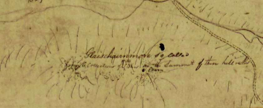
We can only surmise as to what the building looked like. The estate map of 1808 shows it as a rectangular building at the northern end of the bulwark, but 10’ in height doesn’t seem to be high enough to accommodate the machinery necessary, so it may be that a wooden superstructure was added. What we may have here is a contract for the base of the building in stone, probably because it was sitting at or near the high tide line. The requirement for ‘aslar [ashlar] stone’ suggests that it was good quality and looked a very fine building. The roof would have been thatched, but may have been slated in the C18.
A mill dam was constructed by building a dyke or bulwark across the eastern end of the bay and this feature is mentioned in Tours in Scotland, 1677 and 1688 by Thomas Kirk and Ralph Thoresby:
We crossed a bank by a mill, near Stewart Castle, a quarter of a mile over, in the middle whereof were a pair of flood-gates, whereby the dam was filled with the tide, and supplied the mill at low water.
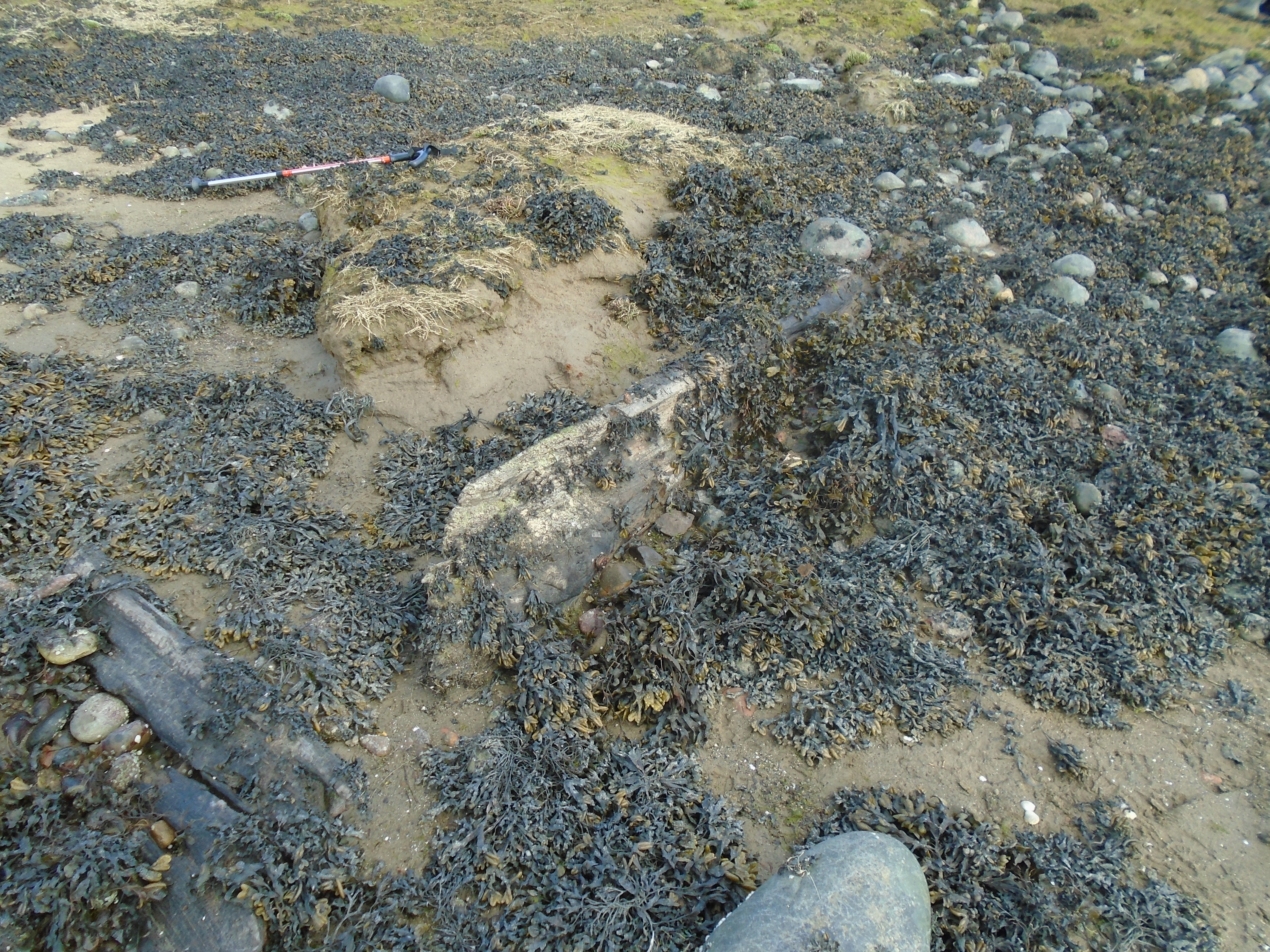
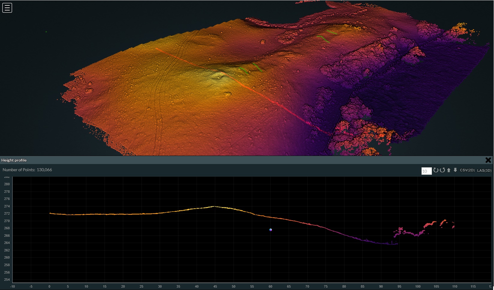
This ‘bank’ is all that remains on the ground and Tom Watson’s aerial shot of the area (below), taken in 2022 when Scape visited the site, shows the remains with what looks like a stone-lined pit for the water-gates over the mouth of the Rough Burn.